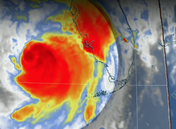
Hurricane Milton just made landfall near Siesta Key, Florida, as a powerful Category 3 storm.
This dangerous storm marks the fifth hurricane to hit the U.S. this year.
The National Weather Service warned of an “axis of extreme rainfall” targeting the Tampa Bay area, which poses a severe risk of life-threatening flash floods. The storm has the potential to become one of the most destructive to ever strike Florida’s Gulf Coast.
Advertisement
Get this, since yesterday, Hurricane Milton’s wind field has more than doubled in size, extending its impact over a significantly larger region. Tropical-storm-force winds are expected to sweep across the entire Florida peninsula, reaching from Miami to Savannah by Thursday, according to forecasters.
Various reports from the National Hurricane Center indicate that a weather station at Egmont Channel, near the mouth of Tampa Bay, recorded a wind gust of 100 mph. Other recorded wind gusts include 89 mph in the greater Tampa area, 93 mph in Sarasota, and a powerful 97 mph gust in Venice.
Tampa itself is entering a dangerous phase of the storm. The unyielding westerly winds that have battered the city are now shifting southward, signaling that Tampa is nearing the eye wall of the hurricane. With the storm’s eye onshore just south of Tampa Bay, the city is closer than ever to the most dangerous part of the storm.
As the winds rage, walls and windows shake violently, and the sky frequently flashes with blue lights as transformers explode across the city and surrounding suburbs. Despite the devastation, somehow, areas near Tampa’s international airport still have power, though the chances of that lasting in the face of the fierce winds seem slim.
This storm has left Tampa and its surrounding areas facing one of the most perilous natural disasters in recent memory, with damage mounting by the minute.


